 News & Events
CLC Newsletters
Phelps Research Area Walk has been rescheduled
for Sunday, October 15th
Stops Include a 19th Century Sugar House
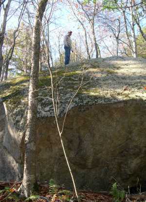
You’re invited on a guided nature/history walk in the Colebrook Land Conservancy’s 394-acre Phelps Research Area October 15th from 1-3 p.m. The preserve’s large size and diverse habit of rocky slopes, woodlands, post-agricultural fields, and wetlands provide habitat for birds that prefer undisturbed forest for breeding. Past uses include a forge along Brummagem Brook and lumbering of what was considered the last extensive old-growth forest in Connecticut, in 1911. You’ll stop at an old sugar house dating from 1865 that was said at the time to have the sweetest sugar because the nearby maple orchard faced north. You’ll also see an historic dwelling foundation and learn about the forge located on the Colebrook-Norfolk town line that operated from 1788 to 1807 and made iron from local ore. The Phelps Research Area in North Colebrook was preserved by John and Nancy Blum (whose ancestor was an original proprietor of Colebrook) and their neighbor and noted ecologist, Dr. Frank Egler. Plan on about 2 hours. Bring water and wear walking shoes. Free and open to the public. No dogs. Not suitable for small children. Rain date will be Sunday, October 15 at 1 p.m. Directions: Follow Route 183 north through the center of Colebrook. Park along Phelps Flat Road, a right turn about 1.8 miles from the center. Walk across Route 183 to the white gate opposite Phelps Flat Road. Leader: Joyce Hemingson, botanist and Conservancy member; for more information, email info@colebrooklandconservancy.org
Meet Your Greens | October 6th
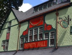 Join us on Thursday, October 6 from 5-7 pm at Infinity Music Hall in Norfolk for Litchfield County's happy-hour networking on environmental issues, conservation initiatives, local farming, land use, and more. This gathering offers time for a broad group of participants to brainstorm ideas and plant seeds for collaboration. All are welcome -- no reservations necessary. (Infinity Music Hall at 20 Greenwoods Road West in Norfolk is a perfect venue for enjoying fall foliage and lively conversation.)
October's gathering is co-hosted by the Colebrook Land Conservancy, HVA Greenprint and Norfolk Land Trust.
Guided Walk in the Phelps Research Area | October 9th
 As part of the Northwest CT Land Trust Days, the Colebrook Land Conservancy will offer a walk on the Phelps Research Area. Sunday, October 9 at 2 PM - 4 PM. (The Phelps Research Area includes scenic forest, brooks & wetlands, abuts an old forge on the Colebrook-Norfolk town line.)
Route 183 near Phelps Flat Rd, Colebrook.
 The Phelps Research Area consists of 394 acres in North Colebrook, preserved by John and Nancy Blum (whose ancestor was an original proprietor of Colebrook) and their neighbor and noted ecologist, Dr. Frank Egler. Its large size and diverse habit of rocky slopes, woodlands, post-agricultural fields, and wetlands provide habitat for birds that prefer undisturbed forest for breeding. Past uses include a forge along Doolittle Brook and lumbering of what was considered the last extensive old-growth forest in Connecticut, in 1911.
Plan on about 2 hours. Bring water and wear walking shoes. Free and open to the public. No dogs. Not suitable for small children. Rain date will be Sunday, October 16 at 2:00 p.m.
Directions: Follow Route 183 north through the center of Colebrook. Park along Phelps Flat Road, a right turn about 1.8 miles from the center. Walk across Route 183 to the white gate opposite Phelps Flat Road.
Leader: Joyce Hemingson, CLC Trustee; for more information, email info@colebrooklandconservancy.org
Pizza Party! Sunday, September 4
Please join the members and friends of the Colebrook Land Conservancy
as we celebrate our 30th Anniversary!
Where: The Hale Barn on Stillman Hill Road
Time: Noon to 3 p.m. on Sunday, September 4

Verona on Wheels is a fire truck with a wood-burning brick oven concealed inside. The thin crust pizzas cook in about 3 minutes, and you can choose your own toppings!
Come sit under the tent and enjoy delicious pizza baked in a wood-fired oven in a pizza fire truck. The menu includes fresh salad, cold drinks, Italian ice and homemade desserts.
There will be guided walks on the Hale Trail, live music, a scavenger hunt, two goats to pet, exhibits inside the barn, and a poetry reading.
Free for members; $10 for guests.
In the event of rain, our celebration will be moved to the Colebrook Town Hall. We look forward to sharing this special event with each of you.

Algonquin State Forest
Sandy Brook Road ~ Colebrook ~ Connecticut ~
September 2011
Prepared For: Connecticut Department of Energy and Environmental Protection
Author: Harry White, Ecologist ~
Colebrook, Connecticut
Funded by the Grant Program of the
Farmington River Coordinating Committee
The Sandy Brook Natural Area Preserve, lying astride the Northwest Highlands and the Northwest Uplands Ecoregions, consists of those portions of Sandy Brook and the adjacent uplands of the Algonquin State Forest and the Kitchel Wilderness lying within 100 feet of Sandy Brook in the town of Colebrook, Connecticut. The uplands, encompassing 43 acres, protect the adjacent salmon and native brook trout fishery, create a scenic corridor, and provide habitat and a migration corridor for upland wildlife. Sandy Brook is considered the highest-ranking Atlantic salmon restoration stream in the Farmington River Basin.
Section 23-5a of the Connecticut General Statutes (CGS) establishes a state system of Natural Area Preserves to preserve the natural attributes of scenic, high-value wilderness areas. To become part of the Natural Area Preserve System, a site must include land or water containing or potentially containing plant or animal life or features of outstanding biological, scientific, educational, geological, paleontological, or scenic value worthy of preservation in their natural condition. In 2002, Governor John Rowland designated the Sandy Brook Natural Area Preserve (NAP). The NAP designation requires a detailed management plan to protect the preserve’s unique species, communities, and other attributes.
Download the Entire Document >>
![]()
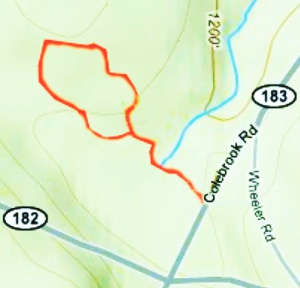
Hale Trail Map:
The Hale Trail is an opportunity to explore a woodland which was a part of a farm dating back to the 1700s. The trail has been created by and the property preserved by the Colebrook Land Conservancy. Enjoy a walk through a bit of New England history. (Average Terrain, Flat Contour, Good for Kids, Medium Difficulty, Rural Area, Scenic Surroundings)
![]()
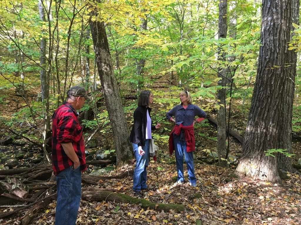
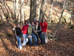
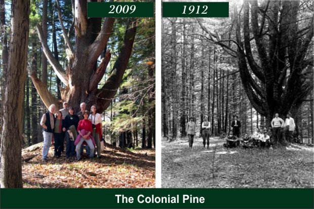
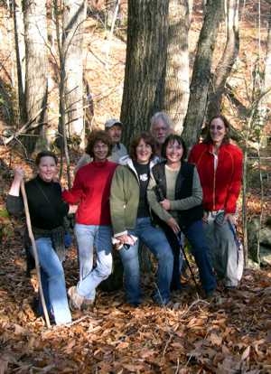
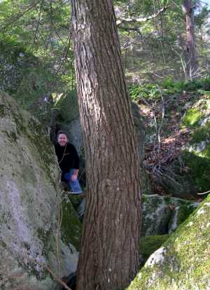
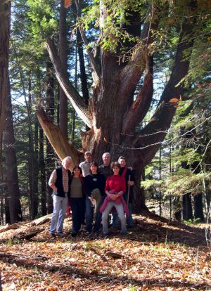
CLC Guided Walk 11-08-09 (Phelps Research Area):
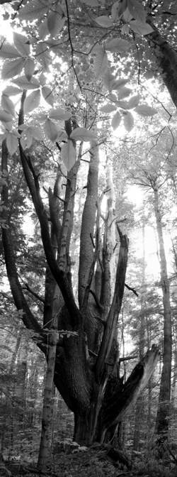
The "Colonial Pine" Same Tree Different Century: This massive Eastern White Pine was named for its 13 leaders representing the original colonies. Joyce Hemingson led a walk through the Phelps Research Area on Sunday, November 8th, 2009, nearly 100 years after the previous photo of the Colonial Pine was made in 1912.
 |
 |
 |
 |